MAPLES TRAIL
Snowbasin Area
September 2009 - 37 photos
Snowbasin Area
September 2009 - 37 photos
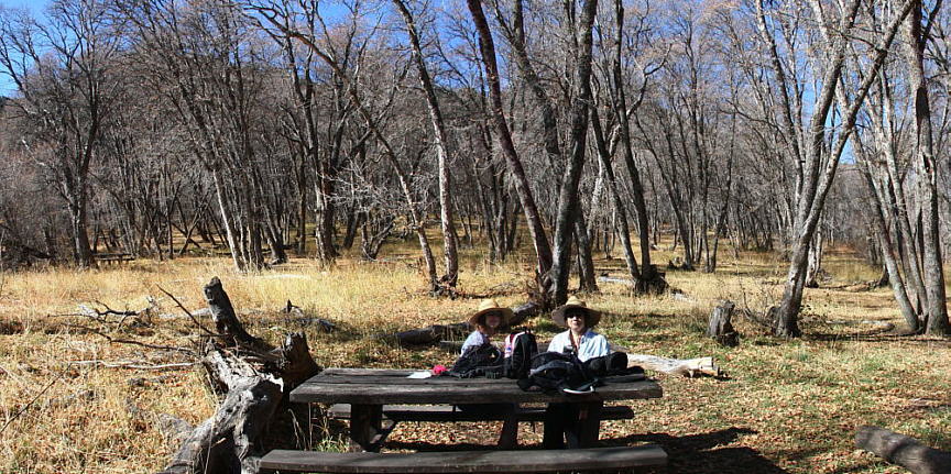
October 25th of 2009, I went hiking with Judy and Georgia again. They asked me to go on a hike with them up in the Snowbasin Ski Resort area. We started out at Wheeler Creek Middle Fork, a few miles below the resort along the old Snowbasin road, and walked up to the Maples Picnic area. We had lunch at the Maples, then went back down the trail about half way. The trail had been frozen earlier, but was now thawing and getting quite muddy, so we climbed
up to the road and followed it back to the car. Most of the trees had lost their leaves at this higher altitude, so
we didn't get the great color in our photos like we had on the Malan's hike. It was a great day though and we enjoyed this hike.
According to my GPS we walked 5 miles, climbing in altitude about 810 feet and back down.
It was still early in the afternoon when we finished this hike, so we drove over to the Green Pond trailhead and walked up to Green Pond. That short walk has been posted on my website as a separate hike. Green Pond Hike
you can view our photos by clicking on any of the pictures here
or the 'View Photos' button
or the 'View Photos' button
The lower end of this trail starts along the Wheeler Creek trail, one beginning by the Art Nord parking area and another fork, farther to the west, up Ice Box canyon. As I said, we started farther up, at Wheeler Creek Middlefork. At the top end the trail meets the road from Snowbasin to the Maples picnic area. Most of the trail was through Maple and Quaking Aspen, with some Scrub Oak and a few pine trees. We crossed over the creek three times on well made bridges.
I snowshoed this trail from top down earlier in the year, so it was interesting to see the same area without all the snow. Also I was surprised to see that all of the bridges had high railings, as the snow was so deep on that hike that it completely covered the railings on the first bridge we came to. As we descended, each bridge was covered with less snow. (snowshoe hike)
I snowshoed this trail from top down earlier in the year, so it was interesting to see the same area without all the snow. Also I was surprised to see that all of the bridges had high railings, as the snow was so deep on that hike that it completely covered the railings on the first bridge we came to. As we descended, each bridge was covered with less snow. (snowshoe hike)
CLICK for GPS map of our trek
- 37 photos -
to look at these photos
click 'View Photos' button
My photos were taken with a Canon EOS 40D, 10.1 Megapixel SLR Camera and the Canon EFs 17-85mm IS wide angle to 5x zoom lens. I carried a Canon EF 70-300mm IS Telephoto for close ups. Some of these photos were taken by Judy Watson with her Canon Digital Rebel SLR and additional lenses
These photos are set to lower resolution and compressed 10:1 for faster loading. You are welcome to look at or download any of the photos. If you use them on any other webpage, please give credit and refer back to me.
[an error occurred while processing this directive]
Visitors on site now (
[an error occurred while processing this directive]
)
Total visits
[an error occurred while processing this directive]
to look at these photos
click 'View Photos' button
My photos were taken with a Canon EOS 40D, 10.1 Megapixel SLR Camera and the Canon EFs 17-85mm IS wide angle to 5x zoom lens. I carried a Canon EF 70-300mm IS Telephoto for close ups. Some of these photos were taken by Judy Watson with her Canon Digital Rebel SLR and additional lenses
These photos are set to lower resolution and compressed 10:1 for faster loading. You are welcome to look at or download any of the photos. If you use them on any other webpage, please give credit and refer back to me.
These photos are set to lower resolution and compressed 10:1 for faster loading. You are welcome to look at or download any of the photos. If you use them on any other webpage, please give credit and refer back to me.


